To help communities, managers, and individuals understand their surroundings by bringing Geographic Resources to the forefront, thereby enabling optimum decision making.
GTMR has a philosophy of doing thorough work in an organized professional manner. We are aware of our customer’s needs and will provide value to your project. We pride ourselves on delivery of a quality product. We can help you understand our product and how it can benefit your property. Please contact us to discuss the possibilities of your project with Geographic Time Management Resources Company. We are here to help.
Homeowner Associations
Communities that need accurate maps and asset inventories for maintenance, planning, and safety.
Property Management
Companies Firms responsible for overseeing multiple properties and requiring consistent infrastructure documentation.
Mobile Home Communities
Parks and manufactured-home communities that benefit from clear mapping of utilities, roads, and infrastructure.
Commercial Properties
Business complexes and commercial sites needing reliable infrastructure records and aerial documentation.
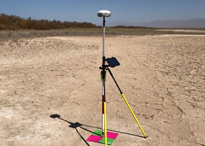
Geographic Time Management Resources Company is primarily a service provider. We integrate Geographic data collection with the customer’s needs. We develop, design and implement a Geographic Database for collection and organization of key data to help your organization see assets in a new way.
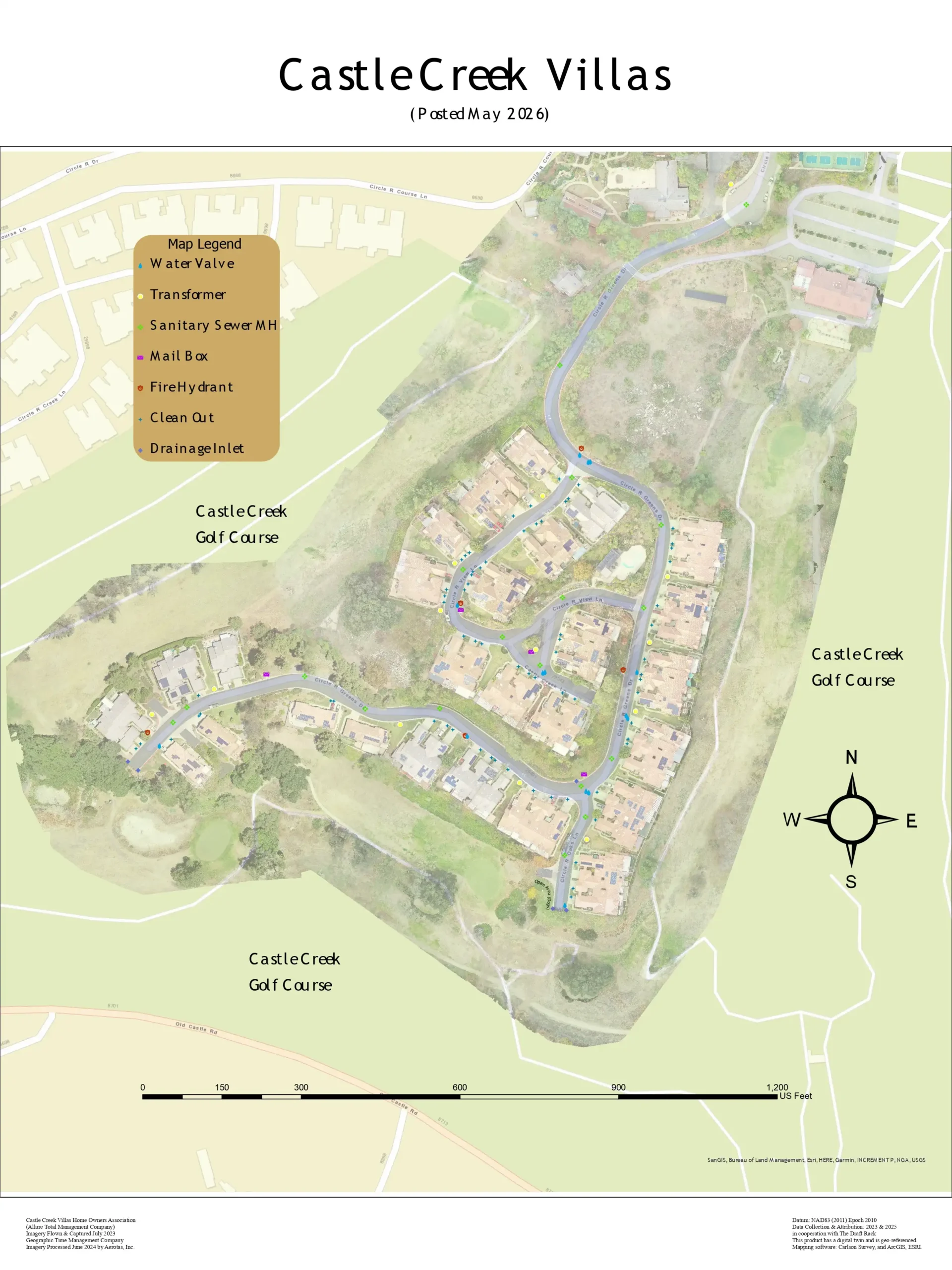
Our team is led by a licensed Professional Land Surveyor, giving our infrastructure mapping the technical rigor and legal defensibility your community demands.
Our team is led by a licensed Professional Land Surveyor, giving our infrastructure mapping the technical rigor and your community demands.
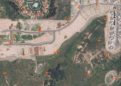
The Modus Robotics Project highlights advanced mapping and data integration to support automation and robotic operations.