

Services
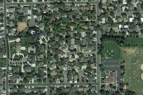
Property Basemap Mapping
Our geo-referenced aerial mapping services provide a complete, high-resolution view of your entire community with exceptional precision. Using advanced drone technology and survey-grade positioning systems, we capture detailed aerial imagery that is accurately aligned to real-world coordinates. This allows planners, engineers, developers, and local authorities to work with reliable mapping data for planning, analysis, and informed decision-making.
Every map is created to deliver consistent accuracy, making it ideal for infrastructure planning, land management, construction monitoring, asset documentation, and community development projects. With clear visuals and dependable geospatial data, our aerial maps help streamline workflows, improve project efficiency, and provide a trusted foundation for both current operations and future planning.


Infrastructure Asset Inventory
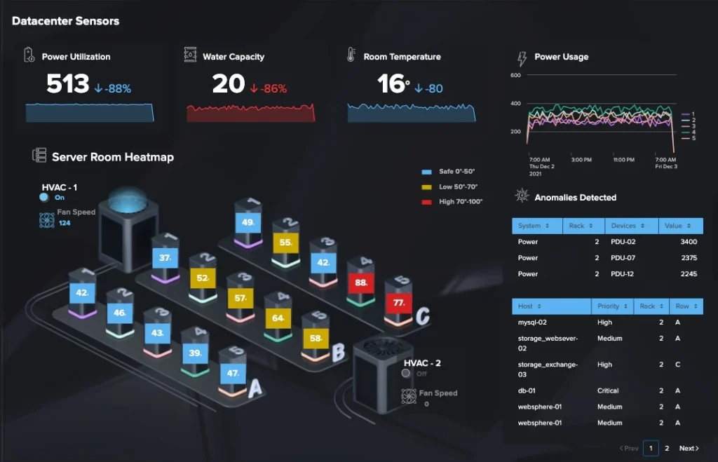
Every critical asset in your community—including valves, manholes, hydrants, transformers, inlets, and other essential infrastructure—is accurately located, documented, and organized into a comprehensive geospatial database. Each asset is precisely mapped using survey-grade data and enriched with detailed attributes such as identification numbers, condition, material, installation details, and maintenance history where available.
This organized asset inventory provides municipalities, utilities, and engineering teams with a reliable, centralized source of information for day-to-day operations and long-term planning. By making infrastructure easier to locate, manage, and analyze, you can improve maintenance efficiency, reduce response times, support informed decision-making, and ensure your community’s critical assets are properly documented for years to come.
Asset Management Systems
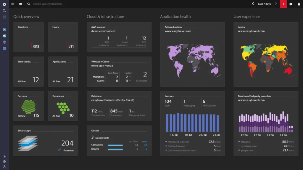
Your data is stored in a live, cloud-based system that is always accessible, searchable, and easy to update—eliminating the limitations of static PDFs and outdated spreadsheets. Instead of relying on documents that quickly become obsolete, your team has access to a centralized platform where maps, assets, and infrastructure information are continuously maintained and instantly available whenever they are needed.
With powerful search, filtering, and real-time update capabilities, you can quickly locate assets, review detailed records, and make informed decisions with confidence. As your community grows and infrastructure changes, your data evolves alongside it, ensuring that everyone works from the most accurate and up-to-date information while improving collaboration, efficiency, and long-term asset management.


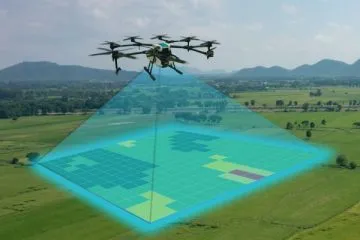
Drone / UAS Mapping
Our high-resolution aerial imagery is captured using advanced drone technology and processed with professional precision to deliver exceptional clarity, accuracy, and detail. Every image is carefully collected using industry-standard workflows, ensuring consistent quality and reliable results for engineering, planning, construction, inspections, and community management projects.
The finished imagery provides a clear and comprehensive view of your properties, infrastructure, and surrounding landscape, making it easier to analyze conditions, monitor progress, and support informed decision-making. Whether you’re documenting existing assets, planning future developments, or tracking project changes over time, our professionally processed aerial imagery delivers the dependable visual data you can trust.
Infrastructure Monitoring Programs
Our ongoing maintenance programs ensure your maps, asset records, and infrastructure documentation remain accurate and up to date as your community grows and changes. Whether new developments are added, utilities are upgraded, or existing assets are modified, we provide regular updates to keep your geospatial data current and reflective of real-world conditions.
By continuously maintaining your documentation, you eliminate outdated information, reduce operational risks, and ensure your team always has access to reliable data for planning, maintenance, and emergency response. This proactive approach helps protect the long-term value of your investment while providing a dependable, future-ready system that evolves alongside your community.
Frequently Asked Questions
We document water valves, fire hydrants, sanitary sewer manholes, transformers, drainage inlets, clean outs, and mailboxes — all geo-referenced with survey-grade accuracy.
Our process includes drone flight, photogrammetric processing, field data collection, and GIS compilation. Timeline varies by property size — contact us for a custom quote.
We serve Southern California and beyond, with our base in San Diego, CA. Serving HOAs, property managers, mobile home communities, and commercial properties since 2015.
You receive a fully geo-referenced basemap, a complete asset inventory, and access to a live ArcGIS digital twin — not just a static PDF.
Accurate infrastructure documentation directly improves reserve study accuracy, reduces liability exposure, and strengthens your position during insurance audits.
We use ArcGIS/ESRI, Carlson Survey, and Aerotas drone processing. All data is geo-referenced to NAD83 (2011) Epoch 2010 standard.